Demystifying Navigation – Introduction
This article is full of map-reading and navigation tips for beginners and especially for those people who may be frightened by the whole subject. I’ve called it “Demystifying Navigation” because I would like to get across that map-reading and navigation isn’t all that difficult. It isn’t some ‘dark art’ that you can only learn in the deepest dungeons of Hogwarts.
These navigation and map-reading tips are written with outdoor activities, such as walking (or hiking), in mind. But it isn’t one of the many ‘how to’ articles and videos available that show you step-by-step how to take a compass bearing, for instance.
Amazingly, by reading this you might discover that improving your map-reading and navigation might just make you less likely to suffer from conditions like dementia and Alzheimer’s Disease later in life. Navigation and map-reading are actually good for your long-term mental – that’s the first tip!
Jump straight to the end of the article if you just want to follow our suggested exercises for developing your navigational skills in three stages.
Table of contents

Who is this article for?
There are map-reading and navigation tips for everyone here, whatever their background and experience. At one end of the spectrum might be those who want to navigate around the National Parks, probably on well-marked tracks and trails. In the middle might be those who want to occasionally leave the better tracks and find slightly vaguer tracks cross-country for short distances. At the top end of the spectrum might be those who want to navigate across wilder access land, possibly in remote areas, with very few paths marked on the maps.
The first navigation tips described later (I’ve described them as “Level 1”) will therefore help someone who wants to get into navigation for the first time and become competent at the easier levels, but is nervous because of their inexperience. The later navigation tips (Level 3) will suit those who want to take enhance their existing navigation but don’t often get as much chance to practice as they might like.
Maybe you can already navigate to a reasonable degree and want a couple of tips for refining your skills. If so, then try reading this tip on planning a navigation leg. If you want an idea for further development, then this explanation of using coarse and fine navigation should help even more.

Frequently Asked Questions
Do I need to navigate when walking/hiking in the UK hills and mountains?
Yes, you do. In the hilly and mountainous areas of the UK, such as in our popular mountainous National Parks, tracks are very rarely signed or marked in any way. There are a handful of exceptions. But for the most part, where popular routes have stone paths, this has been done primarily to reduce and control erosion rather than indicate the way. There are no sign-posts and it is important to be able to navigate as if there were no path.
But what if I don’t know how to navigate?
Think twice about where you go if you are not sure how to navigate. There are consequences to making navigational errors. At the very least, this may mean lengthy detours to get back on your route, or expensive taxi rides to return to your car. At the other end of the scale things can get much more serious. The root cause of many accidents and fatalities in the UK mountains is a navigational error.
What equipment do I need to navigate with?
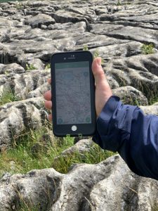
You should always take with you an appropriate map. This is most often going to be an Ordnance Survey or Harvey’s map at 1:50,000, 1:40,000 or 1:25,000 scale. You should also have a magnetic compass, such as a Silva Expedition 4. It goes without saying that you need to know how this equipment. In addition, you could take a GPS unit or an app on a smartphone, but these supplement rather than replace a map and compass. Smartphone batteries have a horrible habit of ‘dying’ very quickly – especially in the cold.
What are the basics of navigation?
The essential components of navigation are as follows:- being able to relate the map to your surroundings on the ground; knowing how to align (or orientate) the map with the ground; being able to interpret the contours on the map from a 2-D picture into a 3-D image in your head; measuring distances on the map and measuring the corresponding distance on the ground; using a compass to help orientate the map; and using a compass to walk on a bearing in a straight line between two points.
Is it good to be able to navigate?
Yes, absolutely. It’s rewarding and fun. You will feel immensely satisfied following a tricky journey using your own navigational skills. You will be able to avoid having an accident and calling Mountain Rescue. What’s more, there is increasing evidence that the mental problem-solving involved in navigation has long-term benefits for your mental health, by helping stave off dementia.
Why we need to read maps and navigate
Map reading for outdoor activities
Someone who participates in outdoor leisure activities will inevitably have the need to find their way from home to some sort of car park. From there, they will need to find their way to where their activity is held (or if walking a route, the walk is the activity). Then they will need to find their way back to the car and back home again.
The bits of journey in the car are almost certainly taken care of these days by the car SatNav. But the car-activity-car bit is down to us.
What happens if we get our navigation wrong?
There are a number of possible consequences of not being able to map-read and navigate successfully:
- The lowest level of impact if we cannot navigate ourselves is simply that we cannot partake in our chosen activity. It could be that we cannot find the place that we are looking for or that we take too long to find it and arrive late. It all amounts to a wasted trip.
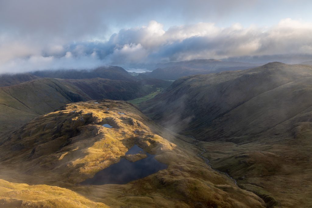
- Beyond this level of minor inconvenience comes the major inconvenience. A great example of this is what happens to walkers who venture up into the high fells of the Lake District and make a navigational error up there. The Lake District resembles a bicycle wheel, with spokes and a rim. The spokes signify the main valleys, where you are likely to have parked a car and started your walk from. If you reach the ‘hub’ in the centre, then take the wrong ‘spoke’ you potentially end up on the completely wrong side of the wheel. Imagine it is 6pm in the autumn and you have just arrived at the first village having walked down off the hills – only to find this is not the village where you parked your car. To get back to your car you have the choice of reversing your steps and walking back up and over the ‘hub’ or taking a taxi. The latter is likely to involve a drive of about an hour (around the outside of the bicycle wheel). It will probably cost you around £70-80. So, following some of these map-reading and navigation tips could actually leave you £80 better off.
- Worse than inconvenience, even an £80 one, comes an accident. Mountain Rescue reports indicate that a major root cause of call-outs to walkers in distress is a navigational error. So, while the Mountain Rescue team may be called out to rescue someone with a broken leg, that’s not the full story. The victim’s leg is broken because he fell on steep rocky ground. He fell because the path wasn’t clear. The path wasn’t clear because it was a small sheep track not a walker’s path. He was on a sheep track because his group lost the main path. They had assumed the sheep track was the path (even though it led the wrong way, but they couldn’t recognise this). They lost the path because they didn’t have navigational equipment or the skills to use them, or both.
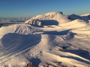
- In the very worst cases, a navigational error in the mountains can lead to a very quick unexpected death. Navigating off the summit plateau of Ben Nevis requires very accurate navigation, and an error can result in a steep fall off the cliffs of the north face.
Reading the right maps
A map is a tool and like all tools, it’s important to choose the right tool for the right job. Screwdrivers are notoriously bad at knocking nails into wood! So, one map-reading tip is to choose the right map for the task in hand.
- This is a bit of light-hearted fun called Tubular Fells by Peter Burgess. It’s a work of art, an amusing record – however you choose to view it. Interestingly, it is actually an accurate depiction of how the different ridge lines and groups of hills interconnect. But it would be pretty useless as a map to help you find your way on the ground – but then it was never intended to be that.
- Another example of an inappropriate map is the typical map used on apps such as Google maps and similar others. It’s not suitable because as soon as you leave towns and villages it doesn’t sufficiently represent what you will see around you.
- Walking in the National Parks, especially mountainous ones, demands the right maps. Suitable maps include the Harvey’s range of maps and the Ordnance Survey outdoor leisure maps. These maps represent what you will see around you – the symbols on them are a sort of ‘language’. But this leads to a problem – you might not speak the language. More about his later, below.
Map-reading in the GPS era
A question that arises very frequently is “Why do I need to learn to navigate when I have a GPS?” It’s a fair question, and one that I’ll attempt to answer. There is a list of reasons that are often cited as to why map-reading skills are still required even though we have GPS, and I’ll describe those. But to my mind there is a deeper and more fundamental reason which is often overlooked.
First of all, there are a number of essential things that must be in place. In order to be able to navigate in the countryside at all using a GPS device, the device must have appropriate mapping (see above) installed on it. Using a GPS (including a smartphone) with only Google Maps (or similar) will never be effective in the great outdoors. However, using a GPS unit, including a phone, with something like Ordnance Survey maps loaded onto it is a viable option.
However, any GPS device, including smartphones, has a number of potential disadvantages. Depending on the device in question, some of these can be mitigated against and some cannot. The great “GPS versus map & compass” debate is usually (and wrongly in my view) very technology-focused. Those who prefer a paper map and compass decry the use of GPS quoting all these disadvantages. Those who favour GPS devices counter these with the various mitigations and solutions available:
- Problem: Short battery life.
Potential solution: Carry spare batteries and/or power pack, solar panels etc.
- Problem: Physical damage.
Potential solution: Choose robust unit or buy shockproof case for smartphones.
- Problem: Water damage.
Potential solution: Choose waterproof unit or buy waterproof case for smartphones.
- Problem: Battery drains suddenly in cold and (usually) phone ‘dies’.
Potential solution: Keep inside pocket or carry spare batteries and/or power pack.
- Problem: Small-screen size makes ‘overview’ or route and distant features difficult or impossible. This leads to a feeling of ‘tunnel-vision’.
Potential solution: No easy solution to this one.
This debate will continue. All the while the technology will improve and gradually these problems associated with GPS units will diminish.
The most important navigational tool – the brain
However, I mentioned that what seems to be a “paper versus technology” debate misses a crucial element. That is the human brain, and what goes on inside it. The part of the brain that is involved in navigation is called the Hippocampus. This part is responsible for “spatial processing” but it is also the part that deals with long term memory. There is increasing evidence that as we rely on technology to do navigation for us, the Hippocampus is being used less and suffers from atrophy – it wastes away. As it does so, our ability to store and recall long-term memory decreases. Conversely, exercising the Hippocampus through spatial processing is understood to increase the neural pathways in the brain. Our navigation gets better and so does our long-term memory.
What does a GPS do for navigation?
Assuming we have a GPS unit or smartphone with suitable outdoor leisure mapping available on it, let’s not overestimate what the GPS unit will actually do for us. When it boils down to it, the only thing that a GPS unit does is show us where we are. Sure, there is lots of additional functionality. We can enter destinations and waypoints, mark points, and record tracks. We can even download routes to follow and so on. Yes, the GPS can point us in the direction of our next destination. But fundamentally it just gives us a fix of where we are.
If we navigate using a map and compass, we don’t have the luxury of the head-start given by having a GPS fix. We must work out where we are ourselves but with the right skills we can do that. From then on, however, there is very little advantage of the GPS over the paper map in terms of what our brain must process if we are to move safely.
It is quite possible to use a GPS without engaging our brain! Using a GPS at the summit of Ben Nevis could still result in our being killed. The straight line direction to the descent path would take us straight over a bend in the north face cliffs. It is very likely that this is what happened in this tragic case of a walker who disappeared on Ben Nevis this year. There are other similar cases which may all be related – following a GPS without truly understanding the map.
Also, with a downloaded or pre-recorded track, all that is required is to walk while keeping our location marker aligned with the track line. In fact, no background map is even required. This is is essentially a kids’ video game keeping a dot on a line. But navigating this way without actually letting our brains read the map can still result in inconvenience or accident or worse.
What map-reading must we do ourselves?
The essence of map-reading is in our brain interpreting the picture on the map (reading a foreign language) and interpreting it. Our brain must then decide on a suitable route, or ‘journey’, and understand what it will be like to undertake this journey. What is the end point? What does it actually look like? What will we see or cross on the way? How will we know if we have gone too far? Is there anything we should beware of, dangers, on our journey? The brain still has to go through this process whether we use a GPS or not.
Why bother? Why not just follow the GPS pointer or keep the location dot on the recorded track? After all, someone has obviously been on that route before. There are a number of answers to this which depend on us and our walking group’s circumstances and abilities; and the weather and environmental factors. For example:-
- Is the way ahead safe? Are there cliffs or other hazards marked on the map? Is the ground too steep for our abilities? Does it go through bogs or other unpleasant obstacles? Only our brain can select the best route for us at that moment.
- Has the weather made this terrain more dangerous? Will this way take us to streams that are uncrossable, having become swollen after heavy rain? Crucially, in winter conditions, is this route taking us onto, or underneath, a slope which is likely to avalanche prone? None of this information is provided by GPS technology itself. Our brain is the only point at which navigational information is fused with weather information, or information from any other sources such as guidebooks or something we have been told.
- Has the situation changed? Do we no longer have time to follow the whole route, nor even to retrace our steps? Do we need to find a short, direct way back to the valley or car? Our brain should constantly be evaluating the overall context in which we are walking for the day and a GPS unit will have no understanding of this.
These are all decisions which a GPS cannot help with – we need to engage our brain and read the map, be it a paper one or the one on the GPS platform.
Tips for embracing navigation and not being scared
For those frightened by map-reading, try not to be. After all, you almost certainly already do all the key elements of map-reading in your everyday life but you just might not realise it. If you have ever done any of the following things successfully then you are already a map-reader/navigator:
- Followed directions given by someone (eg to a shop, bank, pub, etc).
- Looked at and understood an everyday map (eg a town centre plan, map of an amusement park, map inside a shopping mall, etc).
- Used Google maps on your phone to follow directions to somewhere.
- Used a SatNav in your car.
There are a number of different exercises for your brain that you can try. These map-reading and tips will help you to understand better that you can already do map-reading and navigation. Or, if you already know this, these mental exercises will help improve your skills.
What’s great about these map-reading and navigation tips is that they start with simple things and build up. They can be easily incorporated into your daily routine wherever you live or work. It’s all about getting you ‘brain-fit’ for map-reading and navigation. Some of them can be done in the car. (But please only try them when you are a passenger or when they won’t distract you from driving the car safely).
What’s more, doing this sort of mental exercise will develop those neural pathways and potentially stave off dementia later in life.

Orientation – Tips for developing map-reading and navigation (Stage 1)
- Write out directions to somewhere familiar within walking distance – eg from your home to the shops/cash-point/pub. You can probably do this straight from memory. Go out and follow the directions as if you were a stranger and were going to that place for the first time. How well did the directions work? Could they be improved? Keep updating the directions and testing them again until you are 100% sure that a stranger could follow them successfully. This might not mean adding more detail and making them longer – but keeping them short and making them clearer/better. Give the directions to someone else and let them try following them. How did they manage? This exercise is a vital map reading tip, because our brain needs to have created a clear description of our journey before we set off walking.
- Do the same exercise (to a different destination) but this time drawing a map instead of writing directions. Keep testing and improving it as before. Give it to someone else to test when you think it is ready.
- Using what you have learned from the previous two exercises, draw a map from memory to a third location. Try and make it to a slightly trickier destination with more twists and turns. Walk the route using the map twice. First, Walk 1. Feel free to hold the map however you wish, turning or rotating it at will. Then, Walk 2. Follow the route again (or reverse it) but this time start out with one side of your map touching your stomach. Keep that side fixed to you throughout the whole journey without ever turning the map, regardless of which way the journey takes you. Which walk was easier to map-read – Walk 1 or Walk 2?
- You have probably now learned the Golden Rule of map-reading and navigation, the biggest single tip for success, which we call orientating the map. This means holding the map in such a way that the features on the map and the features in the real world are all lined up and pointing the same way.
Description – Tips for developing map-reading and navigation (Stage 2)
- Go on another walk/drive between two places (easy local landmarks), but on a route that you are not so familiar with. This could be by going somewhere you’ve never been or by going between two familiar points but on a route that is not familiar. (For example, you regularly go from home to the shops and know this route well. You also regularly go from home to the pub and know this route well too. However, you have never walked from the pub to the shops). Make conscious observations along the way that would help you if you had to draw a map or write directions for someone:
- What is the start point like? Describe it.
- What is the end point like? Describe it.
- What do you walk along at each stage? Path, road?
- What specific things do you pass along the way?
- In general terms, what is visible to your left along the journey?
- And the right?
- How would you know if you had gone too far and missed your target so you would know to turn back?
- Find out where the points of the compass are in relation to your house – North, South, East and West. Go on a journey, walking or driving, and focus on which direction you are facing every time you make a deliberate turn or the route bends. (For example, you start out heading North. The road turns gradually to the right until you are facing East. You make a right turn, so you are now heading South. A second right turn now takes you West. You go back on yourself round a roundabout so you are now heading East again).
- Go on another journey (walk or drive) and try to understand your position in relation to specific locations.
- Keep a mental track of the direction you are heading.
- Observe locations or areas that are on the left and right as you go on journey.
- Describe where you are in relation to that place – e.g. I am north of the shops.
- Describe where that place is in relation to you – e.g.The shops are to the south of me.
- Go on another walk between two well-known local locations (e.g. from home to the shops). Choose somewhere that will take you around 15-30 minutes to walk to.
- First, walk at what you would consider to be your normal walking pace if this is a route that you walk often. How long did it take? Notice how your body feels during the walk (what does your heart rate feel like? what about your breathing rate? are you sweating? how long and fast are your strides?).
- Now walk it again at pace that is purposeful but very relaxed and you could carry out a conversation throughout. How does it feel this time? How long did it take?
- Now walk it again at a pace that would indicate you were trying to catch a train or a bus, but don’t want to actually break into a sweat. How does this one feel? How long did it take?
- Finally, walk it again as if you were walking along with a small child or an elderly relative. How did it feel this time and how long did it take?
- By now you will have noticed how it feels to walk at different speeds and should be able to judge your walking speed in the future. This is a really useful navigational skill.
- Become familiar with proper maps of your local area. Buy a couple of Ordnance Survey maps (Pink ‘Landranger’ and Orange ‘Explorer’). Start to learn the ‘language’ of the map symbols so that you understand them. How does each map represent places in your local area? What symbols do they use? What differences do you notice between the Pink covered map and the Orange covered map?
Landforms – Tips for developing map-reading and navigation (Stage 3)
- Take another journey and look around as you travel. Observe what things you see and consider how quickly or slowly these might be subject to change. Think about:-
- Paths/roads.
- Woods/forests.
- Rivers, streams and lakes.
- Hills and valleys
- Go on another walk/drive and this time focus on the shape of the land rather than made features such as roads, paths and buildings.
- Does your route take you uphill, downhill or along the flat? If you are going up/down, then how steep is it?
- What is the ground doing on your left side and right side as you make the journey? Does it go up or down to the left or right, and how steeply?
- Can you see any prominent landforms along the journey – e.g. a major hill, an obvious large valley? What about the same forms but smaller?
- Write a set of directions for this journey but this time use references only to the shape of the land.
- Draw a map for this journey but this time as much as possible depict the shape of the land rather than man-made places such as buildings.
- Look up the meaning of the following terms:-
- Hill, summit, knoll.
- Ridge, spur.
- Valley.
- Saddle, col.
- Convex slope.
- Concave slope.
- Buy a couple of Ordnance Survey maps (Pink ‘Landranger’ and Orange ‘Explorer’) of your favourite outdoor leisure area. This may not necessarily be local to you. Try and find examples of these landforms on the map. If you don’t know much about contour lines, then now is the time to do some reading about them.
- Go for a walk somewhere where you can see landform shapes. Try to spot examples of these features on the ground (including in the distance).
- Go and spend some time at a viewpoint, local or otherwise, and try and draw a map of the area you can view. Start with landforms and add in other features later. Mark the map with any of the features named above.
Summary
Navigation and map-reading skills are vital to make use of the great outdoors, especially the mountains, safely. This is just as much the case whether you are using a GPS or not. Hopefully this article has explained why what goes on inside our brain is most important. It has given you plenty of map-reading and navigation tips on how to start training your brain to navigate effectively. What’s more, is it’s all beneficial for your long-term mental health.